


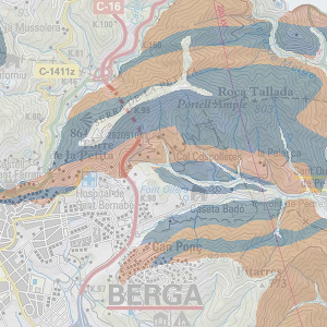
Geology
Major lithological units
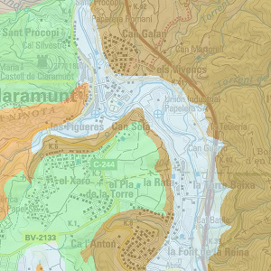
Reclassification of the key of the geological map 1:50.000 (MAGNA) according to the lithological units on the basis of the following basic criteria: type of formation, formation process, response to erosion and types of materials. A total of 16 categories have been distinguished.
Author: Unitat de Geodinàmica Externa i Hidrogeologia – Departament de Geologia de la UAB
Metadata (pdf)
View map (SITMUN)
Surface geological formations
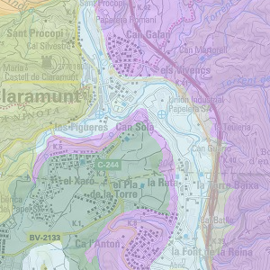
Reclassification of the key of the geological map 1:50.000 (MAGNA) according to surface formations on the basis of previously established geological and geomorphological criteria. Process leading to recent formations originating during the Quaternary, alterations to the main type of substrate and the absence of surface formations were taken into account.
Author: Unitat de Geodinàmica Externa i Hidrogeologia – Departament de Geologia de la UAB
Metadata (pdf)
View map (SITMUN)
Geomorphological units
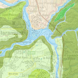
The digitizing of geomorphological units according to expert criteria for identifying forms. Cliffs, slopes, ridges, plains, coastal relief, river valley bottoms, cones of dejection and others have been identified, using 1:50.000 topographic maps and 1:25.000 colour orthophotos.
Author: Unitat de Geodinàmica Externa i Hidrogeologia – Departament de Geologia de la UAB
Metadata (pdf)
View map (SITMUN)
Potential erosion
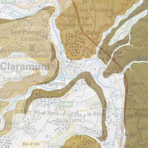
Based on the major geomorphological units and major lithological units, combinations of the two factors were established to define different levels of potential erosion. Categories do not define the level of erosion, but the potential erosion, as they take into account geological factors, but not weather or vegetation cover.
Author: Unitat de Geodinàmica Externa i Hidrogeologia – Departament de Geologia de la UAB
Metadata (pdf)
View map (SITMUN)
Potential gravitational geological hazards
Based on the major geomorphological units and major lithological units, combinations of the two factors were established to define the necessary conditions for the potential development of a gravitational process (falling rocks or small landslides).
Author: Unitat de Geodinàmica Externa i Hidrogeologia – Departament de Geologia de la UAB
Metadata (pdf)
View map (SITMUN)
Hydrogeological units
Reclassification in 15 categories of the geological map 1:50.000 (MAGNA) based on lithology, age and hydrogeological characteristics of materials, taking into account the hydrogeological behaviour of some sectors used as an example. The result is a list of hydrogeological units following an order from most to least hydrogeological interest as geologically formed aquifers.
Author: Unitat de Geodinàmica Externa i Hidrogeologia – Departament de Geologia de la UAB
Metadata (pdf)
View map (SITMUN)
Vulnerability of hydrogeological units
The categories of vulnerability of hydrogeological units were obtained by considering the behaviour of different material outcrops and their hydrogeological relationship, based on the joint assessment of the following parameters: ease of infiltration or penetration of the substance in subsoil, and ease of propagation and circulation of groundwater, based on the qualitative permeability of the subsoil. The legend includes six categories of vulnerability where category 1 represents the areas of greatest risk of contamination of aquifers and category 6 the lowest.
Author: Unitat de Geodinàmica Externa i Hidrogeologia – Departament de Geologia de la UAB
Metadata (pdf)
View map (SITMUN)
Àrea de Territori i Sostenibilitat
Comte d'Urgell 187, 3a planta, Edifici Rellotge
08036 Barcelona. Tel. 934 022 896