Mapping and Assessment of Ecosystems and their Services
Introduction
The ecosystems in the province of Barcelona are mainly forest types (forests, scrub, meadows, grasslands, etc...) and agricultural ecosystems, highlighting as well the specific ecosystems linked to urbanization, which are especially present in the metropolitan area of the city of Barcelona. As shown in different editions of Land Cover maps of Catalonia (MCSC , CREAF) the metropolitan area has suffered a drastic drop in agricultural surface (almost 58% ) over the last decades, much of which has been transformed into urban coverage and, to a lesser extent, forestry surface. These changes in land cover and use have direct implications in relation to the provision of ecosystem services within the field of study, especially in terms of supply services, as well as for the demand of these services, as the increase of urban surface is proportional to the increase of population.
PROVISIONING SERVICES
Food (crops)
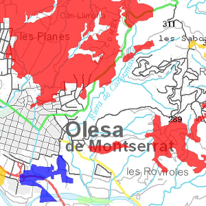
The food products can come from various ecosystems such as forests (mushrooms, hunting wildlife, etc.) or fluvial and marine ecosystems (fishery products), but mainly comprise the agricultural ecosystems (pastures and crops) that are the most relevant in this function, especially in the province of Barcelona. In this first approach to the mapping of this role have only taken into account the production of agricultural crops intended for human consumption, calculated from agricultural average yields in biophysical value (kg/ha per year).
Author: Institute of Environmental Science and Technology (ICTA) and Barcelona Province Council
Metadata
Forest biomass (CREAF method)
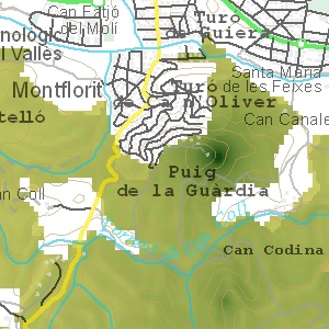
The provision of forest biomass refers mainly to service production of raw materials (building material/furniture and fuel) from forest ecosystems, this means wood and firewood. As in the previous case, other ecosystems, such as agricultural, can provide biomass as commercial wood or fuel (for example, woody biomass energy crops), but they have not considered at this stage because of its minor relevance in the area of study. It must be highlighted that mapped indicators show the ability of forest ecosystems to provide this service, i.e., the potential supply of the service, which obviously does not match with the annual extraction of biomass in the form of wood or charcoal (which correspond to the use or service flow). Likewise, only the total aboveground woody biomass has been considered (sum of the fractions of woody biomass: wood, bark and branches) of tree species. Estimation of the indicator is based on the calculation of biomass average increase (t/ha per year) from the formula: (B_IFN3 - B_IFN2) / 11, where 11 are the years between the completion of National Forest Inventory (IFN) 2 (1990) and IFN3 (2001).
Author: Institute of Environmental Science and Technology (ICTA) and Barcelona Province Council
Metadata
Forest biomass (Farmers Union method)
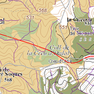
The provision of forest biomass refers mainly to service production of raw materials (building material/furniture and fuel) from forest ecosystems, this means wood and firewood. As in the previous case, other ecosystems, such as agricultural, can provide biomass as commercial wood or fuel (for example, woody biomass energy crops), but they have not considered at this stage because of its minor relevance in the area of study. It must be highlighted that mapped indicators show the ability of forest ecosystems to provide this service, i.e., the potential supply of the service, which obviously does not match with the annual extraction of biomass in the form of wood or charcoal (which correspond to the use or service flow). Likewise, only the total aboveground woody biomass has been considered (sum of the fractions of woody biomass: wood, bark and branches) of tree species. Estimation of the indicator is based on the layer of Agricultural Dynamism 2013 (Farmers Union, 2013) and on the table of forest yields (Farmers Union, 2013), which includes the estimated average net growth of forest each category (in t/ha per year).
Author: Institute of Environmental Science and Technology (ICTA) and Barcelona Province Council
Metadata
REGULATING SERVICES
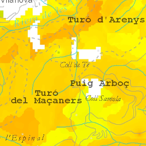
Global climate regulation. Air carbon stored in the tree layer of forests (t/ha) for the year 2001
Biomass storage occurs mostly in forest ecosystems, mainly woody crops also can accumulate significant amounts of carbon and, therefore, also contribute to the global climate regulation. Even the urban ecosystems (parks, gardens, woodland road, etc.) are able to provide this service, although moderately. To be able to map this service, have been used cartographic bases to evaluate the ecological status of the forest in the area of the SITxell (Pino, 2007), because it includes a cartographic modelling of data from forest inventories (IFN2 and IFN3). In accordance with this results, the total storage of aerial carbon in the Sitxell forests are over 10 million tons in the year 2001 (National Forest Inventory, IFN3).
Author: Institute of Environmental Science and Technology (ICTA) and Barcelona Province Council
Metadata
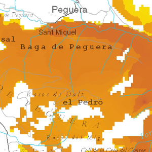
Global climate regulation. Air carbon stored in the tree layer of forests in the area of SITXELL (t/ha) projection for the year 2013
Assuming that the annual flow of carbon between both national forest inventories (IFN2 and IFN3) is kept linear, can be projected the estimated carbon storage present in SITxell's forests by 2013. According to this premise, the forests of the area of the SITxell would be accumulating in 2013 about 11.11 million tons of aerial carbon. Calculation of the woody aboveground biomass of the IFN2 from the formula: B_IFN2=B_IFN3/(1+ΔB/100). Calculation of the average increase of biomass in tons/HA per year with the following formula: (B_IFN3–B_IFN2)/11, where 11 are the years between the completion of IFN2(1990) and IFN3(2001).
Author: Institute of Environmental Science and Technology (ICTA) and Barcelona Province Council
Metadata
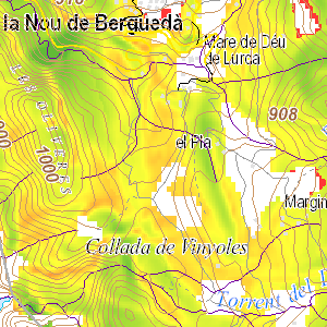
Global climate regulation. Air carbon captured annually in the tree layer of forests in the area of SITXELL (kg/ha per year)
The estimation of air carbon captured annually in the tree layer of forests in the area of SITxell (in kg/year) considers a linear annual increase between 1990 (IFN2) and 2001 (IFN3). From the map of IFN3 (National Forest Inventory 2001) biomass, and the map of net increase in biomass between inventories has been able to map carbon captured annually. Keep in mind that these results only show the captured carbon fraction of aerial tree layer (wood, bark, branches), and therefore do not consider carbon underground biomass (roots) or what is present the shrub layer, herbaceous or even necromass accumulated in the soil (which may be higher than the total carbon biomass).
Author: Institute of Environmental Science and Technology (ICTA) and Barcelona Province Council
Metadata
Erosion Control
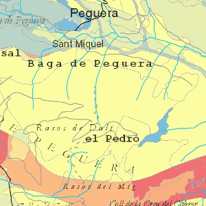
Erosion control or regulation is an ecosystem service which can be defined as the capacity of ecosystems (mainly
vegetation) to retain soil and prevent sudden or gradual erosion (landslide). The service can be quantified in biophysical units, for
example, through the amount of soil retained (kg/ha and year) by vegetation. In this case, the chosen option has been to make an approximate assessment
based on the index of potential erosionability (SITxell) and a generic values of the capacity of land covers to control erosion based
in expert knowledge (Burkhard et al., 2012).
Author: Institute of Environmental Science and Technology (ICTA) and Barcelona Province Council
Metadata
CULTURAL SERVICES
Potential recreational opportunities
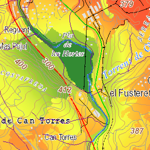
Recreational and leisure outdoor opportunities offered by ecosystems represent one of the most important cultural ecosystem services for human welfare,
services. Especially in a highly populated area such as the Barcelona province. Quantification, modelling
and evaluation of cultural services pose a major challenge, since, unlike provisioning or regulating services, they are intangible benefits
and, therefore, subject to the perceptions and preferences of the people. With the aim of mapping the potential of recreational
opportunities generated by the ecosystems within the SITxell area, the ESTIMAP (Ecosystem Services Mapping Tool)
model has been used. This model estimates the potential capacity of ecosystems to provide recreational opportunities or outdoor leisure
based on a set of components (1-the degree of naturalness; 2-natural elements (except water); 3-infrastructures; 4-water elements).
It is assumed that all of these variables influences this provision in greater or lesser extent.
Author: Institute of Environmental Science and Technology (ICTA) and Barcelona Province Council
Metadata
SUPPORTING SERVICES
Habitats for species
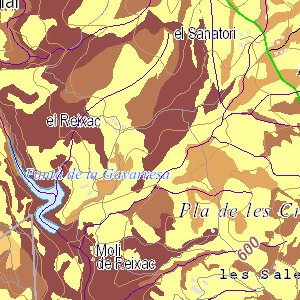
Each ecosystem provides different habitats that may be essential for the life cycle of the species, including those
migratory who depend of them. The map of botanical interest (VGI) of habitats is calculated taking into account the rate
of chorological interest and the rate of intrinsic interest of the habitats used in the SITxell project. This cartography represents
a good indicator to assess this support ecosystem service.
Like other services already analyzed, higher values in this map corresponds in many cases to natural protected areas of the province of Barcelona and freshwater areas.
Author: Grup de Recerca de Geobotànica i Cartografia de la Vegetació (UB) (GEOVEG)
Metadata
Àrea de Territori i Sostenibilitat
Comte d'Urgell 187, 3a planta, Edifici Rellotge
08036 Barcelona. Tel. 934 022 896


