català | castellano | english


Historical maps
Land Cover Map of the province of Barcelona in 1956
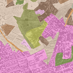
Digitizing of land cover in 1956 (CREAF methodology for Cover Map of Catalonia) on ortophotography from 1956 (Barcelona Provincial Council), also known as the “American flight”. The map shows the distribution of the main land covers (forest, agricultural, urban) and allows an analysis of its evolution to the present.
Author: Centre de Recerca Ecològica i Aplicacions Forestals (CREAF) i Diputació de Barcelona
Metadata (pdf)
View map (SITMUN)
Àrea de Territori i Sostenibilitat
Comte d'Urgell 187, 3a planta, Edifici Rellotge
08036 Barcelona. Tel. 934 022 896